Top 10 Things to do in Rapid River, Michigan (MI)
Discover the best top things to do in Rapid River, United States including Haymeadow Creek Falls Trail, Rapid River Ski Trail, Peninsula Point Lighthouse, Maywood History Trail, Peninsula Point Lighthouse Interpretive Trail, Felch Grade Route ORV Trail, Bay de Noc to Grand Island Trail, Forest Island ORV Trail, Norway ORV Trail, Rapid River Pub.
Restaurants in Rapid River
1. Haymeadow Creek Falls Trail
Overall Ratings
5.0 based on 1 reviews
Haymeadow Creek Campground is located approximately 11 miles from Rapid River. Take US-2 east from Rapid River 1.6 miles, turn left on Co. Road 509 and go north 9.4 miles to the entrance. The campground is near Haymeadow Creek and has direct access to two hiking trails.CampingThere are 15 large campsites, all with tables and fire rings. Drinking water is available at a hand pump and there are toilet facilities. Please be sure to pack out what you pack in, as there are no trash receptacles.FishingHaymeadow Creek is a high quality trout stream. Anglers will be challenged to catch the wary brook trout.HikingThere are two trailheads to the Haymeadow Falls Trail - one in the campground and another 1/4 mile north on Co. Road 509. The well-marked trail from the campground takes you along a winding path, across small bridges, through a heavily forested area lined with many varieties of ferns and wild plants. The trail of approximately 1 mile leads you along the creek to the footbridge at the Haymeadow Falls rapids. Continue on to the second trailhead and back along the road to the campground, or you can reverse this pattern by parking at the second trailhead, taking the trail to the rapids, and on to the campground and back to your car. There are blue markers along the entire length of the trail.A short 1/2 mile spur near the north trailhead connects you to the 40 mile Bay de Noc Grand Island National Recreation Trail, which is used for hiking and horseback riding.General InformationGroceries and gasoline are available in Rapid River. Haymeadow Creek Campground is a no-fee area.ContactAdditional information about the Haymeadow Campground and Falls Trail is available from the Rapid River Ranger District or the Forest Supervisor's Office.Information courtesy of the USDA Forest Service
2. Rapid River Ski Trail
Overall Ratings
5.0 based on 2 reviews
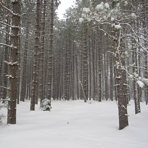
The Rapid River ski trail offers five loops suitable for hiking and biking. The trail is widely recognized as one of the most beautiful in the Upper Peninsula, as it winds thru towering pine-covered ridges and drops into thick lowland swamps, offering a wide variety of challenges, from gentle, flat terrain to long, steep hills. The trailhead is located six miles north of Rapid River on US Highway 41.
3. Peninsula Point Lighthouse
Overall Ratings
4.0 based on 28 reviews
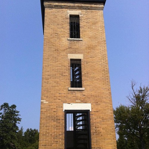
The 40 ft. lighthouse tower is an easy climb on a circular staircase to a beautiful view from the platform at the top. The spectacular panorama of lake Michigan is unparalleled. Be sure to bring you camera.The rocky shoreline yields fossils estimated at 400-500 million years old. In the fall, thousands of monarch butterflies converge on the area to rest before their migration across Green Bay.General InformationTo reach the Peninsula Point Lighthouse and Picnic Area from Rapid River, go east on US-2 to the Stonington exit. Follow County Road 513 and Forest Road 2204 for 19 miles to the parking lot. The last mile of road is not recommended for recreational vehicles or trailers over 16 feet long or 8 feet high. A parking area for RV's is available at the beginning of the narrow, winding final mile of road.HistoryCongress appropriated funds for the building of a lighthouse on the Stonington Peninsula on July 20, 1864. This marked the beginning of an era of lighthouse history that well over a hundred years later can still add fuel to the fires of imagination. The wooden sailing ships needed navigational help to keep their hulls from being torn open on the treacherous shoals of the channels leading to safety at the docks of Escanaba and Gladstone, Fayette and Nahma. There were busy ports transporting fish, lumber, iron ore and other products. The shipping industry was growing at a rapid rate.The U.S. Government recognized the need for a lighthouse on the peninsula to aid navigation around these dangerous shoals and reefs separating Big Bay de Noc, Little Bay de Noc, and Green Bay of Lake Michigan.The Michigan historical lighthouse at Peninsula Point was completed in 1865, and the lantern was lighted for the first time. The building consisted of a 40 ft. tall light tower with a beacon lit by an oil lamp and reflectors. Attached to the north side of the tower was a 1-1/2 story brick home for the and his family.The first lighthouse keeper was Mr. Charles Beggs, who died there in 1887. The second, Mr. Henry Corgan, and the third, Mr. Peter Knutsen. In 1889 Captain James D. Armstrong was appointed keeper and this was home to him and his family until 1922. At this time an automatic acetylene light replace the hand operated oil lamp ant it was no longer necessary to occupy the site. However, Captain Armstrong continued to be responsible for Peninsula Point until 1931.The light went out for the last time in 1936. In 1937, the USDA-Forest Service was granted custodianship, repairs were made to the buildings, and public picnic grounds were constructed by the Civilian conservation Corps.The Stonington Grange took over the maintenance of the structure and grounds and in 1949 won first prize in their State contest for their work at the Michigan historical lighthouse.The house portion burned to the ground in 1959. The debris was cleared and the damage to the north side of the tower repaired in 1962 by the USDA Forest Service.Picnic GroundsThe USDA Forest Service operates the grounds as a picnic area, with 10 tables and grills on the lawns surrounding the tower. Pit toilets are available, as well as drinking water.Information courtesy of the USDA Forest Service
Reviewed By Ramikat
We were delighted to see many monarchs feeding on milkweed that grows around the lighthouse. Lighthouse is charming as is the peninsula. Of course we were there on a sunny August morning. If the weather was cold and windy it may not have been so pleasant. Paved road ends about a mile from the lighthouse. You drive down a one lane gravel/dirt road with a few pull-offs. Visitors from far away were there to see the monarchs before they continue on their migration. Picnic tables
4. Maywood History Trail
This hard packed easily accessible trail takes the visitor through a 200 year old hemlock forest on the shore of Little Bay de Noc. Because of its geographic setting, the area was a focal point of human activity and includes Native American sites and the foundations of an old resort hotel complex. Abundant historic photographs and oral history quotations on interpretive signs tell the Maywood story.
5. Peninsula Point Lighthouse Interpretive Trail
The 40 ft. lighthouse tower is an easy climb on a circular staircase to a beautiful view from the platform at the top. The spectacular panorama of lake Michigan is unparalleled. Be sure to bring you camera.The USDA Forest Service operates the grounds as a picnic area, with 10 tables and grills on the lawns surrounding the tower. Pit toilets are available, as well as drinking water.
6. Felch Grade Route ORV Trail
The Felch Grade Trail is a 40 mile trail open to hiking, mountain biking, motorcycling, and snowmobiling.
7. Bay de Noc to Grand Island Trail
The Bay de Noc-to-Grand Island Trail parallels the Whitefish River, starting from 1/2 to 2 miles east of the river. The trail follows the approximate location of an ancient Chippewa Indian portage route used to carry canoes and supplies between Lake Superior and Lake Michigan. Following the river bluff for a considerable distance, it offers the hiker many extended views to the west across the Whitefish River Valley.
8. Forest Island ORV Trail
Forest Island Trail is a 33 mile trail open to hiking, motorcycling, atving, and snowmobiling.
9. Norway ORV Trail
Norway ORV trail is located in Norway, MI and is labeled as an ORV trail.
10. Rapid River Pub
Overall Ratings
4.5 based on 2 reviews


