The 8 Best Nature & Parks in Gjesdal Municipality, Western Norway
Discover the best top things to do in Gjesdal Municipality, Norway including Fitjanuten Hiking Trail, Manafossen Falls and Man Farm, Gloppedalsura Rock Fall, Gloppedalsura Scree, Husavatnet, Hike from Stole to Skreda, Hike from Blafjellenden to Hunnedalen, Gloppenuten.
1. Fitjanuten Hiking Trail
2. Manafossen Falls and Man Farm
Overall Ratings
4.5 based on 46 reviews
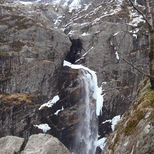
Manafossen is Rogaland's biggest waterfall and Norway's ninth tallest free fall waterfall. From the parking area you proceed on foot along the southeast bank of the river. The path up to Manafossen is steep and rugged in places. The steepest spots have steps and chains that you can hold on to as you climb. From the path you have a fine view over Manafossen, which has a free fall of 92 metres. The waterfall is protected and is one of Rogaland's biggest tourist attractions. You can continue your trip into Mandal and visit Man farm. This was the first farm that was cleared in Fidjadalen valley - probably already in the early Middle Ages. On the lush grassy slopes around the main building there are numerous remnants of the mountain farm that was in use until 1915. Today the restored farmhouse is the only remaining original building. A new building sleeps 34 persons. In the basement you'll find an exhibition featuring the mountain farm's history, the conservation area Frafjordheiene and the work of the Jaeren Recreational Council. The basement also serves as a heated shelter, where you're welcome to warm up while you eat your lunch when visiting Man farm. Follow the signs from the turnoff at algard, in the direction of Byrkjedal. Parking.
3. Gloppedalsura Rock Fall
4. Gloppedalsura Scree
Overall Ratings
4.5 based on 12 reviews
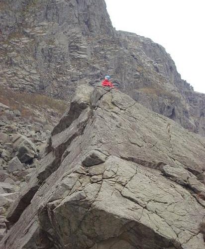
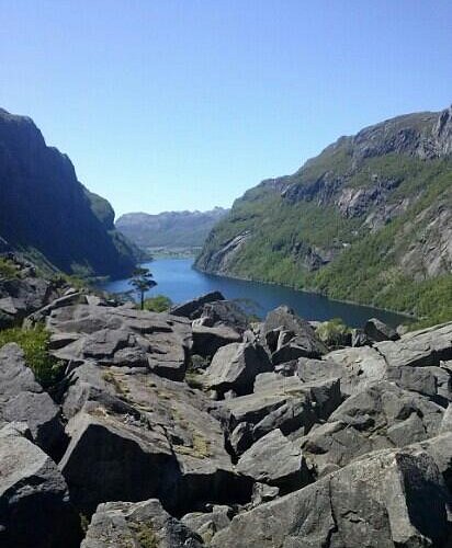
Gloppedalsura consists of avalanche boulders that are piled on top of an end moraine. 10,000 years ago the ice sheet that covered the area, melted away. For a period of time the massive end moraine dammed the Hunnedal river's former course, towards Veen and Vikesa, and formed a lake in Byrkjedalsgryta. The terraces in Byrkjedal at 240 metres altitude are evidence of this moraine-dammed lake. The annual cycle of frost and expanding ice broke free a vast number of boulders and rocks and sent them tumbling down the southern mountainside. This debris settled as a 100-metre thick scree on top of the moraine. Hunnedal river and the lake in Byrkjedalsgryta were forced to find a new outlet the water burrowed a gully from Byrkjedal towards Gilja - Giljajuvet.
Reviewed By 55edd - Buzzards Bay, United States
The Magna Geo Park is huge and the highlight is this scree, the largest in Europe, containing most of a mountain that fell millennia ago. Norwegian military bravely held off vastly superior Nazi forces during World War 2. The views of boulders are incredible, bit DO NOT stop for vies and pictures unless it's at a pull-off, since the road is quite narrow.
5. Husavatnet
Bathplace near the Kyllingstad community hall. Beach, toilet, football pitch, playground. Good access for disabled peoples. Parking
6. Hike from Stole to Skreda
Starting Point: The walk begins at Stole Turisthytte. Description: From the cabin, walk eastwards through oyestoldalen to oyestol. Walk through the narrow gorge called Trongane which at a first glance appears impassable, but there is a paved mountain road through the gorge. At the end of the gorge the valley opens up, continue straight ahead over the path crossroads to the Flaeet (flat area). As you come to the 'Heimre Trongane (a narrow valley / canyon), the terrain becomes more hilly, continue until the landscape opens up again keeping above the small hill marked Brudle on the map. ('Brudler' are stones laid in a long row and are associated with an old wedding tradition. Traditionally, stones were laid by the bridal couple and their guests on their way to the wedding celebration. (There are many such 'Brudle' to be found in Sirdal). Continue down the ravine to Indra Grunnetjodn tarn, from here walk along Skredane through Skredadalen to Skreda. For a detailed description including maps and information etc buy the guidebook 'Hiking in Sirdal' which includes Kjerag and Sirdals Seven Summits
7. Hike from Blafjellenden to Hunnedalen
Starting Point:The hike begins at Blafjellenden turisthytte. Description: The trail starts in the middle of the cabins at Blafjellenden. Follow the signposted path in the south-easterly direction towards Hunnedalen. After five minutes you begin a 200 meter ascent up to 820 meters (allow roughly 45 min). At the top of the ravine the path crosses the left hand side of the marsh, look for boards that are laid out along the bog. Pass between two tarns, stepping stones have been placed in the tarn so that it is easy to cross. The landscape is very hilly. The tarns are more or less your means of finding your bearings. Continue in the south-easterly direction past a lake where another path crosses yours on your left hand. At the end of the lake follow the right side of the river that flows into an elongated tarn 150 meters ahead. Follow its short north-western side to the end and then turn south-east along the long side of the tarn. At roughly the halfway mark, the path veers towards a round tarn on your right, which you follow along its shore. At the end of these tarns, cross a sheep fence and then climb to the top of an outcrop from where you can see the cabins in Hunnedalen. You then follow the wide path of the old thoroughfare and farm road down to the main road in Hunnedalen (Hogaleitet). For a detailed description including maps and information etc buy the guidebook 'Hiking in Sirdal' which includes Kjerag and Sirdals Seven Summits.


