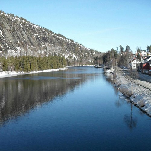
The 6 Best Outdoor Activities in Amli Municipality, Southern Norway
Discover the best top things to do in Amli Municipality, Norway including Bike Trip Nelaug-Arendal, Hike to Trogfjell Mountain, Bike Trip Vallekilen-Tovdal, Old Skjeggedalsvegen, Trogfjell Via Ferrata, Visit Wilderness.
1. Bike Trip Nelaug-Arendal
Overall Ratings
5.0 based on 1 reviews
Nelaug-Arendal, 33,2 km (max 38,9 km) Tip: Take the train from Arendal to Nelaug. Several departures each day. The cycle route Nelaug-Arendal is divided into two different routes, where the eastern route is marked with signs. Follow signs from classified road no. 412 at Nelaug, on gravel surface east of the river Nidelva. This is a pleasant stretch, with a partly course surface. On the way, you pass a farmyard at Vimme, Flaten station and Haugsja station. Shortly after, the surface becomes paved at Boylefoss on classified road no 151. The hill at the gate before Boylefoss is steep. At Boylestad, exit left off road no 151 and onto gravel surface once again. Follow the gravel road straight ahead until the road turns left by the water, take to the right in the crossroads before Hersel. From there, the road goes uphill again, follow this straight ahead through the woods to Lyngrott [ikon VII]. Here the landscape becomes more open, and the road passes Gullknapp airport. Go straight ahead, past several beautiful waters, and then downwards to Tveiten, on classified road no. 128, through Myra and down to Arendal town centre (signs from E18). Take the road straight ahead in the traffic lights and the roundabouts, to Barbu, then to the right along Langbrygga and Pollen in town. Before Barbu, you find the railwaystation, the starting point for those who took the train to Nelaug. (1] Follow the gravel road from Lyngrott to the left at the bicycle sign. The route is on gravel surface for a while, then asphalt past Bjornes and Skjaevestad, to Longumvannet. Go west of the water, most people must wheel the bike for about 800 metres along the water. This route leads to road no. 128 at Myra, og left and follow the road to town. 5,7 km longer.
2. Hike to Trogfjell Mountain
Overall Ratings
4.5 based on 4 reviews
The trip to Trogfjell in the centre of amli follows the bridge amfoss bru, one of the longest stone bridges in Northern Europe. The trail is not demanding, about 1.6 kms one way, and it takes about 1,5 hours to hike - round trip. At the top, you'll be about 430 metres above sea level. Both children and adults can easily do this hike. This is a marked cultural trail with 12 checkpoints to the top of the mountain Trogfjell. When you reach the peak, there are binoculars and a guest book. Previously, people took the train to amli to go hiking at Trogfjell, and amli people used to celebrate Midsummer Eve on the mountain. There is an old legend explaining why it is called Trogfjell, and the answer can be found in a painting at the Elvarheim museum. Parking is at Elvarheim Museum. Part of the peaks of amli project.
3. Bike Trip Vallekilen-Tovdal
Simonstad-Tovdal, amli, 31 km (max 41 km) one way Along roads with no bicycle paths. The starting point is the hotel Pan Garden, south of Pmli, where there’s accommodation, walking paths, padling possibilities and more. Follow along the hard shoulder on classified road no. 415 some kilometres towards amli, then turn left on road no. 413. At Dolemo, turn right to Hillestad Galleri (sign), here there’s less traffic. The road follows the Tovdal River about 20 km, and at the Tveit water, Tovdal church is located. Hillestad galleri (gallery) and holiday facility is nearby, on the right side of the road [1]. [1] Further up the valley Tovdal, the road leads to Dale, about 10 km further up into the valley. Here you can park your bicycle and go for a hike, for instance to the waterfall Rjukanfossen, about 2 hours hiking round trip.
4. Old Skjeggedalsvegen
Old Skjeggedalsvegen is a demanding trail of 7 km one way. The hike is about 6 hours long return trip. A long time ago, this was the only way to get to Skjeggedal. The road used to be good enough to drive with a horse and wagon. This is a nice trip in varied terrain, suitable for experienced hikers with stamina. Skjeggedalsvegen between Tovdal and Skjeggedal in Southern Norway has two starting points and you can choose where to start either from Tveit in Tovdal or from lower Skjeggedal. There is a guestbook and puncher in the post-box on a tree at the border/on the mountain between Skjeggedal and Tovdal. From Tveit in Tovdal: Drive from Dolemo to Tovdal, pass the shop, take a left turn at the sign for Tveit. Drive on to the gravel track, past two farms. Parking: Drive through the farm until you see an information board and park here. From lower Skjeggedal: Leave road no. 42 between Evje and Arendal towards Skjeggedal/Risdal. Follow the road to Skjeggedal, approximately 11 km from Risdal. There is an information board and parking on the left-hand side by a red garage. The trail starts on the other side of the road by a small red garage and is marked in red. The trail follows the old route between Tovdal and Skjeggedal. Part of the peaks of amli project.
5. Trogfjell Via Ferrata
Overall Ratings
5.0 based on 3 reviews

6. Visit Wilderness
Overall Ratings
5.0 based on 1 reviews


