The 10 Best National Parks in New Mexico, United States
With its rich cultural heritage from Native American and Spanish settlers, New Mexico has been both a Spanish colony and a Mexican colony, and still retains a strong individual identity within the United States. The landscape is breathtaking, the food incredible, and there is a thriving cultural scene, all of which makes New Mexico, and Santa Fe in particular, a great place all year long.
Restaurants in New Mexico
1. White Sands National Monument
Overall Ratings
5.0 based on 4,059 reviews
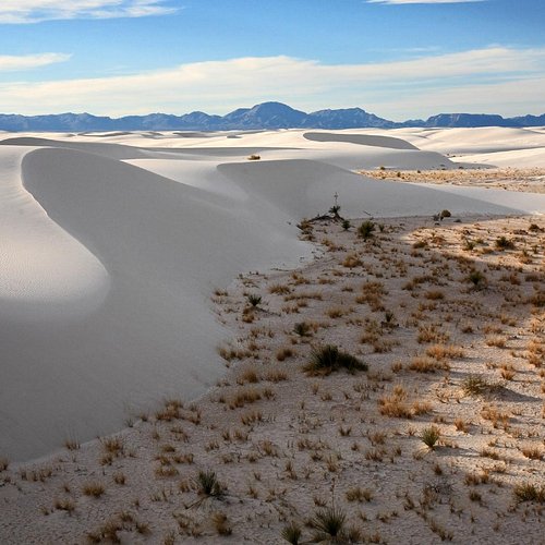
Visitors to this endless waterless sea can enjoy driving, hiking, visiting a museum and sledding down the huge dunes.
Reviewed By waynefromcali - Yucaipa, United States
Like an ocean wave of rare white crystal gypsum sand-White Sands National Monument in the desert of New Mexico is known for dramatic landscapes of rare white gypsum sand dunes.In 2019 White Sands National Monument was redesignated White Sands National Park by The United States Department of the Interior Office of National Parks. . . . . . #whitesands #newmexico #desert #nationalparks #usdeptoftheinterior #hiking #natgeoyourshot #natgeomyshot #whitesandsnationalpark #dunes #sanddunes #ilovesanddunes #route66 #alamagordo #albuquerque #deserthighway #ilovenewmexico #leicacameras #hasslebladcameras #canon #nikon #sonycameras #film
2. Pecos National Historical Park
Overall Ratings
4.5 based on 430 reviews
Pecos National Historical Park commemorates thousands of years of human travel through the area. This includes hundreds of years of human habitation, such as Pecos Pueblo and the Spanish Mission Church. The Santa Fe Trail came through the park, as did the original path of Route 66. The Civil War brought the Battle of Glorieta Pass here, where Confederate ambitions for the Southwest stopped. The Forked Lightning Ranch boasted Northern New Mexico dude ranching and the home of Tex Austin, E.E. "Buddy" Fogelson, and Greer Garson. Whatever your interest in New Mexico, from archeology to modern rodeos, Pecos National Historical Park is connected!
Reviewed By mvidro - Washington DC, United States
We spent more than half a day. This included two excellent ranger-led tours -- Ancient Sites (led by Nate) and the Civil War (led by Suzan). In between, we shopped in the fine gift shop (with its wonderful selection of Native American pots), saw a 12 minute film, narrated by Greer Garson (who apparently lived nearby) and ate a picnic lunch near a flintknapper who sold his work (I bought a lovely spearhead of speckled Zuni chert). As the Civil War tour included just me, my friend (a long-time Civil War buff) and the ranger, Suzan drove us to three sites associated with the Battle of Glorieta Pass. That meant we got the benefit of her expertise throughout, rather than just at the locations themselves. For example, at the first site we saw a monument raised by the Daughters of the Confederacy. That sparked a discussion on how controversial Civil War monuments can be. We heard both the pro and con sides -- very balanced. This was a fascinating and worthwhile day.
3. Petroglyph National Monument
Overall Ratings
4.5 based on 1,874 reviews
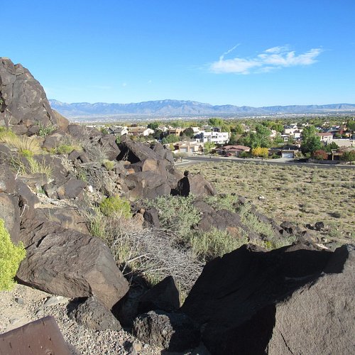
Up to 15,000 petroglyphs or prehistoric rock art images have been found on the West Mesa volcanic escarpment, located along a 17-mile canyon outside of Albuquerque.
Reviewed By jbushman2017 - Fresno, United States
Perfect for Covid times. This site is an archaeologists dream as there are few places where you can see so many petroglyph's in such a place as you will see here. Visitors drive to the visitor center (which is closed) to pick up a map that shows three places within the monument area where you can visit the petroglyphs. My wife and I picked up a map and then drove 10 minutes down a road to visit one of the sites. The site included three very small walking trails (all less than 500 meters) from which you could get up close to these amazing petroglyphs. Visiting is all free and it is only about 15 minutes from downtown by car. Do wear shoes and bring water. Please "like" this review if you find it helpful.
4. Chaco Culture National Historical Park
Overall Ratings
4.5 based on 701 reviews
Chaco Canyon holds one of the largest collection of prehistoric buildings on the continent.
Reviewed By BelindaC9876 - Orlando, United States
Getting to the canyon is tough. Dirt roads with washboards that will make you and your vehicle shake like in a paint vibrator. Some visitors were not happy at all with the experience. My sister and I travelled in with a compact RV and made it ok. This rough experience that lasts almost an hour really behooves you to stay overnight at the Gallo Campground if you intend on staying for more than a day (would you should). Make reservations if you can. Visitor Center has trail guides to help explaining markers that you will see at the houses and on the trails. Must see Pueblo Bonito, and highly recommend the arduous Pueblo Alto Trail (do the full 5.4 miles) that will take up on the mesa and give you beautiful views of the canyon and of the houses. Our road trip started at Chaco Canyon which was great because we learned so much about the architecture spanning several hundred years and about the culture.
5. Hyde Memorial State Park
Overall Ratings
4.5 based on 224 reviews
Located in a breathtaking natural setting, this park is ideal for picnics and camping.
Reviewed By 9gaylem - Santa Fe, United States
We just spent a couple of nights in a yurt in Hyde Park. Very nicely outfitted and perfect for people who don’t have a lot of camping gear but want to enjoy the outdoors. The three yurts are fairly close to each other which is too bad, but our neighbors were quiet and not a bother. The skylight is great for star gazing in the night and the 6 beds that come with the yurt were comfortable. Very close to the Borrego Trail - a lively hiking trail that is popular with Santa Feans. Also so close to town if you get tired of cooking on a campfire, it’s a 15 minute drive to downtown Santa Fe and 10 minutes to 10,000 waves.
6. Carson National Forest
7. Santa Fe National Forest
Overall Ratings
4.5 based on 45 reviews
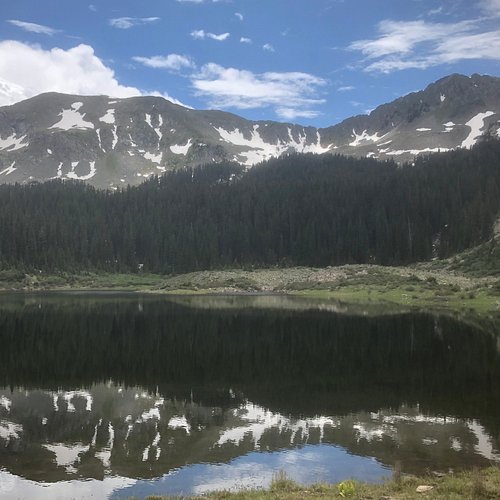
Scenic area located in Northern New Mexico that offers excellent outdoor recreation opportunities in its mountains, rivers and canyons.
Reviewed By lindapF1137CO - Oklahoma City, United States
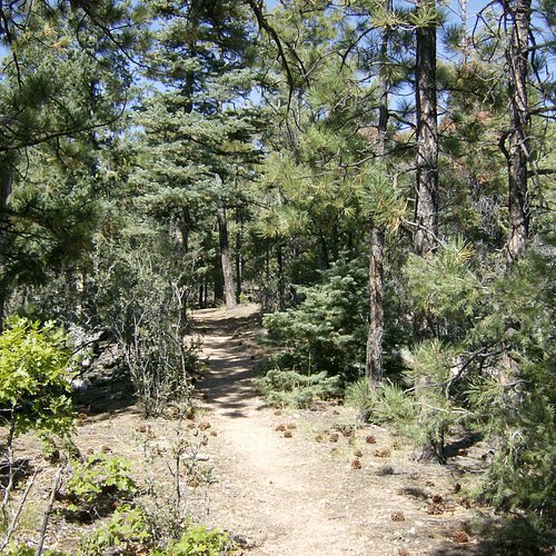
We were here for a long weekend and the temp was in the 60’s, a little cooler in the mountains-perfect for hiking. We only wanted a short hike so we went to the ski shop near the ranger station and hiked the marked trail. It was easy to follow since the path was cleared but it is pretty steep in parts. We did the waterfall trail and it was about three miles. So beautiful! We stayed in Santa Fe and it took about 35-40 minutes to drive up here, well worth it.
8. El Malpais National Monument
Overall Ratings
4.5 based on 310 reviews
National monument with spectacular scenery.
Reviewed By Mike5466
While definitely tough-to-explore badlands, El Malpais National Monument is not the lifeless volcanic vastness I had expected. Rugged plants and lichens have surprisingly done their best overtaking each and every vesicle, crack, fracture, or crevasse. Enhancing with colors, smells, and textures an incredibly challenging landscape of primeval basalt charred black from eons of slow oxidation. El Malpais is home to some of the oldest Douglas Fir (pseudotsuga) trees in the American Southwest, the eldest clocking over 1,300 years! The same tricky-to-reach lava fields which have curtailed their growth, thanks to poor growing conditions, have also protected them from forest fires, animal (grazing) or human (logging) harm, and possibly diseases. Sadly, the latest drought accompanied with today’s higher temperatures is killing some trees that grew and survived 7+ centuries of wide-ranging growing conditions. Some of these trees were alive long before Spanish conquistadors first set eyes on, and named, this area El Malpais (the badlands) since they couldn’t cross the lava field with their horses and livestock unable to navigate its perilous flows on the way to the West Coast of Mexico. There almost wasn’t an El Malpais National Monument. In the 1940’s, the area was one of the possible sites being considered by the Manhattan Project for testing the first atomic bomb. Eventually, the area near White Sands National Park was chosen as the site for the Trinity nuclear test. While it escaped the atomic bomb, the area was used as a bombing range for pilot training during WWII. The area was handed to the BLM after the war, and in Dec 1987, it was designated as El Malpais National Monument by President Reagan and now spans 114,000 acres in the SE corner of the Colorado Plateau. You can spend several days here, I spent only a couple of them wandering the area from towering sandstone bluffs to mysterious lava sinkholes and from majestic stone arches to intriguing ropy pahoehoe. Thanks to a particularly wet monsoon season in this area of New Mexico, it wasn’t too dry or particularly dusty. Animals, birds, and insects all enjoying the various water holes left from the storm. This volcanic field is relatively recent (700,000 to 3,900 years ago) and well preserved. Its extensive lava-tube system contains more than 290 caves in lava flows and 15 major lava tubes. Laid end-to-end, they would stretch more than 60 miles. If all intact, this tube system would be the longest in North America. Many of which hold seasonal or perennial accumulations of ice. Some of the ice is more than 3,100 years old. Unfortunately, present-day accumulations of perennial ice appear to be at an all-time low. With Covid (and white-nose syndrome in bats), none of the caves were open, so I’ll have to come back to see for myself. Enjoying this unique landscape, it is difficult to imagine that over 150 million years ago, during the Jurassic period, portions of this area resembled the Sahara Desert of today. For the geologically inclined, this is a rugged paradise of extreme backcountry displays where five distinct lava flows lie beside and atop one another, in places reaching 475 feet thick. One of the world’s youngest lava flows named McCartys features some of the most pristine examples of lava formations on earth, thanks, in parts, to the really dry environment. Thirty cinder cones, volcanic remnants far more ancient than the main lava fields, rise along the horizon. In other words, ‘El Malpais is like a pop-up textbook of the magmatic forces that shaped our planet.’ Finally, this area also contains a few kipukas, a Hawaiian term that refers to an ‘exposure of older rock not covered by an overlying lava flow’ or ‘an island of vegetation surrounded by lava flow’ are undisturbed areas that lava flows surrounded but did not cover. These ecological islands of vegetation create islands of native plant and animal communities. Study of the flora and fauna that thrives in the kipukas yields valuable information for restoring disturbed portions of El Malpais. Go through places called Lava Falls – only 50 feet of elevation gain but rough terrain. Need good shoes and good balance. Only a 1-mile train where you will see: Natural Amphitheater, Pygmy Forest, Sink Holes, trenches, and ridges. Learn new words related to volcanology: lava toes, ropy pahoehoe, tachylyte, pressure ridges, squeeze-ups, rough and broken a’a, and the most common of all, basalt. See brightly colored lichens: grays, oranges, neon greens, yellows, steely blues, clinging to the lava rocks. Have picnic or explore the Sandstone Bluffs: Where sharp lava meets smooth sandstone. From 400 feet high, watch the black lava flows of El Malpais, towering ponderosas at the base of the bluff, tall Mount Taylor way in the background, and sweeping vistas in all directions. Place of contrasts in a harsh yet beautiful landscape. Nearby are the ruins of the old 1934 Garrett Homestead. After rainfalls, the potholes, or tinajas, fill with water and create temporary miniature ecosystems. Fairy shrimp, tadpole shrimp, spadefoot toad tadpoles and water insects find homes in these tiny oases. Look for these small animals after summer rains fill the shallow depressions. The tinajas atop of the bluffs undoubtedly supplied people with water as well. There is something for everyone here. Many trails I haven’t had time to follow but will definitely be back. Enjoy this very peaceful stark place.
9. Gila Cliff Dwellings National Monument
Overall Ratings
4.5 based on 353 reviews
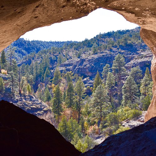
Surrounded by Gila National Forest and at the edge of Gila Wilderness, this area contains dwellings of the Mogollon Indians who lived here in the 13th century.
Reviewed By 788connieb
If you can’t make the trip to Colorado, but want a true Southwest experience, don’t miss the Gila Cliff Dwellings. The hike to the site, alone, is wonderful. Then, when you reach the cliff dwellings, park docents provide valuable information about the Mogollon inhabitants. To access the park, drive about 40 miles out of Silver City, New Mexico toward Pinos Altos. Once you leave that cute village, the road becomes rather twisty, but around every turn is another remarkable view. Plan to embark before noon in the summer, as the park closes at sundown. The ride home often includes elk and deer crossing on the road. Drive carefully! Although some folks might be tempted to race up the trail to the ruins, take your time and enjoy the beautiful piñon forest. At the end of your tour, rest a while by the river side and take in the sounds and fragrances of this delightful mountain retreat.
10. Fort Union National Monument
Overall Ratings
4.5 based on 156 reviews
Reviewed By RondaTravelTime - Maricopa, United States
Authenticity! Enjoy the visionary past as you stroll along the Santa Fe Trail, visualize the events on the parade grounds, and observe the military housing where troops prepare for invading native tribes and Civil War battles of the Southwest! Staff is knowledgeable and congenial while keeping the structures in pristine condition! Worth every inch of the eight mile drive from the interstate.

