The 10 Best Hiking Trails in Parnu County, Parnu County
Discover the best top things to do in Parnu County, Estonia including RMK Kilingi-Nomme Hiking Trail, Hiking Trails of Joulumae Recreational Sports Centre, Rannametsa Tolkuse Nature Trail, Riisa Trail, Parnu Rannaniidu Matkarada, Nigula Trail, Uulu Nature and Study Trail, Kaisma Exercise Track, Antu Punamagi, Laiksaare Forest Trail.
Restaurants in Parnu County
1. RMK Kilingi-Nomme Hiking Trail
Overall Ratings
5.0 based on 1 reviews
The 5.2 km forest trail starts from the Kiling-Nomme forest hut of the State Forest Management Centre (RMK). You will find a map of the trail on the wall at the trail’s start. Boardwalks help you cross the wetter parts of the trail, wooden steps protect the delicate surface of hills from ramblers and a wooden bridge leads across the stream where beavers have been building dams. The study trail consists of 12 viewing points and was created by naturalist Hendrik Relve. There is a nature class at the start of the trail. Hikers can rest on the benches that have been arranged in a circle, have a bite to eat and schools can use the area for lessons about nature. Take your family and your dog with you and come walk the trail!
2. Hiking Trails of Joulumae Recreational Sports Centre
Overall Ratings
5.0 based on 1 reviews
There is a 5 km nature trail in the pine forest on the dunes near Joulumae Health Centre in Parnu County and also three longer marked hiking trails (10, 15 and 25 km). The longest of them reaches the Rannametsa-Tolkuse Nature Trail. You can buy the Joulumetsa orienteering card with 20 permanent checkpoints from the administrator (1.60 €) and use it to go and discover the surroundings.
3. Rannametsa Tolkuse Nature Trail
Overall Ratings
5.0 based on 18 reviews
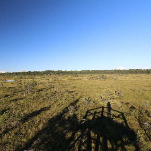
The dunes in Rannametsa have always been a popular place among hikers. Trails and information boards have been built here to protect the delicate nature and still introduce the nature of Luitemaa to visitors.The 2.2 km circular trail, parts of which are a boardwalk, passes through the pine forest on the dunes and Tolkuse Fen, leading to the largest swamp pool of the fen (approx. 96 x 210 m). An 18 metre viewing tower has been established on the top of Tornimagi, the highest dune in Estonia, which takes you more than 50 metres above sea level so you can see as far as 50 km away and even spot Kihnu Island.
4. Riisa Trail
Overall Ratings
5.0 based on 13 reviews
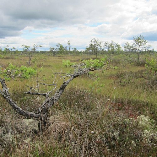
You will find a sign by the Joesuu-Toramaa Road that invites you on a 5 km hike along the boardwalk in Riisa Fen.The trail starts on the fen and briefly runs through the forest. In places like this, you can see the forest turning into a fen and vice versa – dry ground is replaced by wet land, swamp plants with ancient spruce forests. You can also seem some beautiful swamp pools by the trail.The location of Riisa makes it one of the most popular trails in Soomaa as the road and car park are right by its gates.
Reviewed By djakob38 - Canton of Bern, Switzerland
It's about 4.8km, easy to walk because of the wooden boards, you won't have more than 80 mins for the round-trail. Very quiet, some parts are in the forest, but most of it is in the open bog.
5. Parnu Rannaniidu Matkarada
6. Nigula Trail
Overall Ratings
4.0 based on 1 reviews
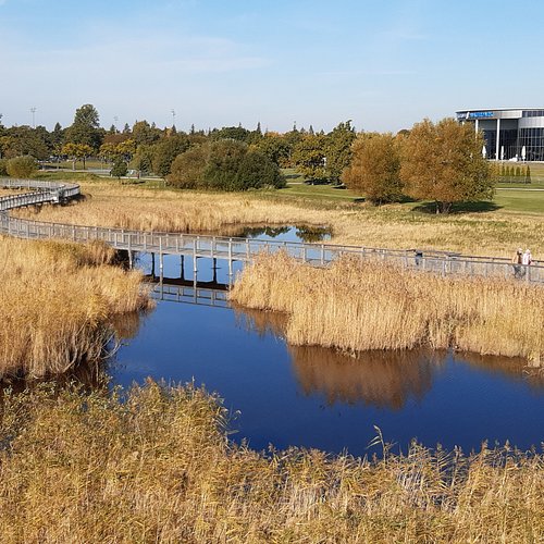
Nigula Nature Conservation Area has a 6.8 km study trail that runs along a boardwalk. You will get a partial overview of the trail when you hike for about 1 km to the first viewing tower by Lake Nigula. The trail splits in two by the viewing tower and runs through the bare fens towards the forest. The two braches form a loop, which can be covered in about 2 to 3 hours. There are different viewing towers by the trail. And it is great to have a refreshing picnic by the lake after a good walk on the trail! There are a car park, information board and toilet by the start of the trail.
7. Uulu Nature and Study Trail
Overall Ratings
3.0 based on 1 reviews
The 7 km trail that introduces local history, culture and nature starts by the main building of Tahkuranna Rural Municipality, which was built in the place of the mansion of Uulu Manor destroyed in 1917. Information boards have been set up in nine viewing points and the direction of the trail is marked by red arrows. The trails takes you to the former deer garden, Akaatsia alley, rectory, the crypt of the manor family, the forest, the mouth of Uulu canal, picturesque beaches, etc. You can have a rest on one of the benches by the trail, the beach or the stones of the pier.
8. Kaisma Exercise Track
Overall Ratings
3.0 based on 4 reviews
Lake Kaisma Suurjarv is a 1.2 km² fen lake in the northern part of Parnu County. It is connected to Lake Kaisma Vaikejarv in the middle of the fens and the area between the two lakes is a prime example of untouched nature.The 1.3 km exercise track runs around Lake Kaisma Suurjarv and gives you the chance to enjoy the beauty of the lake, fens and forests. Parts of the track are boardwalks. You will find a map of the track at its start. There are many information boards introducing the nature and a watchtower on the track.You can hire a boat from the rest area next to the lake and go out onto the lake. You can also spend the night and go to the sauna, set up a tent or stay in a caravan.
9. Antu Punamagi
The hill is 23 m high. The Punamae esker is an important object of heritage protection because Agelinde, the largest three-part stronghold in southern Virumaa, was located on its southern edge. The Red Hill is 1 km away from the Antu Lakes.
10. Laiksaare Forest Trail
The 2 km forest trail is equipped with information boards and its aim is to introduce the type of forest called ‘lammimets’ in Estonian. These types of forests grow in flooded valleys and are quite rare in Estonia. Hiking on the trail gives you the chance to see the plant communities characteristic of such forests. You also have to cross footbridges and fallen trees on the trail. There are two forest huts on the trail where you can rest and make a fire, or even stay for the night. Take a look at the protected oak tree and the tallest European White Elm in Estonia (31.3 metres) before you head for the trail. Useful information: Laiksaare (Patchy Island) was named like this because farms in the area were dotted like little island patches among the swamps and forests.


