The 10 Best Hiking Trails in Aust-Agder, Southern Norway
Discover the best top things to do in Aust-Agder, Norway including Kollen at Fjaereheia, Hove and Spornes, Hill Hike in Grimstad, Hovdenuten, Fransasenloype, Hike to Trogfjell Mountain, Ardalsknapen in Bygland, Fevik via Hasseltangen, Heritage Walk, Hiking in Evje and Hornnes.
Restaurants in Aust-Agder
1. Kollen at Fjaereheia
Overall Ratings
5.0 based on 4 reviews
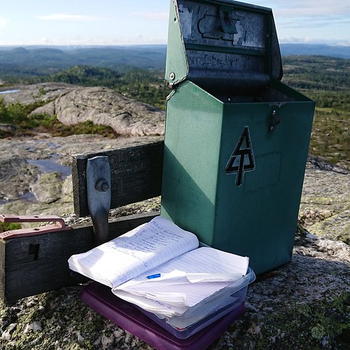
Follow the recommended route to Dommesmoen. Continue along the floodlit trail for 100 metres, then turn right and follow the trail towards Deidalen. Some wet areas. At the first crossroads, turn left and then left again by a small lake. By the sign “Kollen, 2.6 km”, turn right. Then turn right and follow the old railway line for 200-300 metres. Climb the steep Orrekeiv to the left and follow the tractor tracks to Kollen, 1.9 km. At the top, you can enjoy the tranquillity and views towards the mountains and lake Rore. The route is marked with red triangles/red paint. As you return to the railway line, turn right and follow the road along the lake. After 1 km, you’ll reach the floodlit trail. Turn left and continue to the car park by Dommesmoen. Duration: Approx. 1 hour is required for the 4.2km walk from Dommesmoen to Kollen. For the 10km roundtrip, some 2 hours is needed. Terrain: Varied, exciting countryside. Some wet areas. Sturdy shoes and a reasonable level of fitness required. Level of difficulty: Medium Suitable for: The area is not suitable for wheelchair/pram.
2. Hove and Spornes
Overall Ratings
5.0 based on 80 reviews
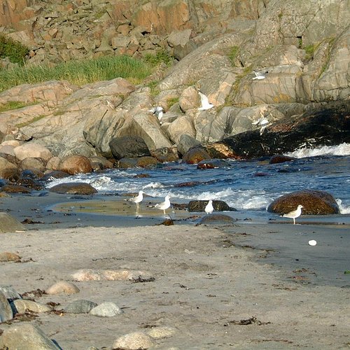
On the southern part of the island of Tromoy, only 10 minutes from Arendal town by car, bus or boat, there is a beautiful area called Hove. This recreation area is part of a protected moraine that lies along the southern coast. The whole area has been adapted for walks with resting places along the shore. There is a beach and kiosk at Hove camping during the summer season, and several kilometres of smooth rocks. Sundays between September and May, there is a lunch buffet at Hovestua in Hove camp from 12 to 18. The paths are many and stretches from Hove to Alve, along Spornes beach, consisting of boulders and rocks, and sand when the sea permits. The area is used for hiking both summer and winter, and is suitable for everyone, children and adults. The trip from Hove camping to Alve and back is about 12 kms, and the network of paths allows both short and long trails. Maps for sale at Arendal tourist office, Hove camp, and Bjellandstrand Gard. Parking for instance at Hove camping and Hove camp. Bus no 3 to Tromoy ost leaves Arendal every hour during the day, Monday-Saturday.
Reviewed By Samadhi33 - Arendal, Norway
Hove and Spornes has it all... The beautiful forest to hike in with sunlight pouring in between the trees; the sandy beach for sunning, swimming and picnics on warm summer days; and the "rullesteinstrand" (rolling stones beach) for communing with nature, with the wide ocean horizon spread out in front of you and the sound of the waves crashing over the stones. Here you can find real relaxation any time of the year, a break from an otherwise busy life. Plenty of activities also for families with children. They'll love it as much as you will. If you're in the Arendal area you definitely don't want to miss the old Viking ground Hove and the beaches of Spornes.
3. Hill Hike in Grimstad
Overall Ratings
5.0 based on 1 reviews
By the tourist office, cross the road at the traffic lights. Turn left, and continue along Pharos Vei. At the very end of Hoyvardeveien is the first hilltop: Vardeheia, 41 m a.s.l. Stunning views, and within an easy 10 min. walk from town centre. Enter Vestregate and then follow Storgaten until you reach Frivoldveien. The next hilltop is Floyheia, 63.5 m a.s.l., with beautiful views to the sea, town and countryside. This trail has been created based on Knut Hamsun’s work, “On Overgrown Paths”, and you’ll find quotes from the book along the way. Some steep sections, but Hamsun was 88 years old when he did this walk. Mollerheia, 41.9 m a.s.l., is the hilltop prior to the descent down to Kirkegaten. Cross over to Kirkeheia, 27 m a.s.l., with its beautiful park and the wooden Grimstad Church - Norway’s second largest of its kind. Binabben, 58.5 m a.s.l. and the last of the hilltops, offers an excellent “forest walk on wellkept paths to the vantage point. Spectacular 360° view towards countryside, town, harbour, archipelago and sea. At the top is a panorama disc with distances and details on what’s what in every direction. Duration: approx. 1 ½ hours. Terrain: Varied, some hilly areas, exciting countryside. Sturdy shoes and a reasonable level of fitness are required. Level of difficulty: Medium Suitable for: Both Vardeheia and Kirkeheia are suitable for wheelchairs/prams.
4. Hovdenuten
5. Fransasenloype
Overall Ratings
4.5 based on 4 reviews
12 km long hike starts from Risor centre. Follow the blue marked trail through uneven terrain. Fantastic view from the top Fransasen, about 4 to 5 hours hike.
6. Hike to Trogfjell Mountain
Overall Ratings
4.5 based on 4 reviews
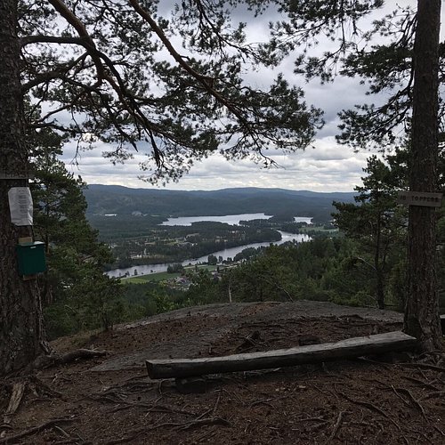
The trip to Trogfjell in the centre of amli follows the bridge amfoss bru, one of the longest stone bridges in Northern Europe. The trail is not demanding, about 1.6 kms one way, and it takes about 1,5 hours to hike - round trip. At the top, you'll be about 430 metres above sea level. Both children and adults can easily do this hike. This is a marked cultural trail with 12 checkpoints to the top of the mountain Trogfjell. When you reach the peak, there are binoculars and a guest book. Previously, people took the train to amli to go hiking at Trogfjell, and amli people used to celebrate Midsummer Eve on the mountain. There is an old legend explaining why it is called Trogfjell, and the answer can be found in a painting at the Elvarheim museum. Parking is at Elvarheim Museum. Part of the peaks of amli project.
7. Ardalsknapen in Bygland
Overall Ratings
4.5 based on 2 reviews
The path to ardalsknapen starts at Neset Camping. The first part is rather steep. the path runs through wooded areas and up above the tree line (762 m.a.s.l.) You can return on the same path. The trip takes about four hours. You can park your car at Neste Camping.
8. Fevik via Hasseltangen
Overall Ratings
4.5 based on 10 reviews
From the tourist office, followSmith Petersens Gate towards Arendal. Continue past Grimstad Church and Grimstad Town Hall on the left, and follow the foot and cycle path across Biesletta. Cross the road by the Bieheia turn-off, and continue along the foot and cycle path on the right hand side until you reach Vikkilen. Follow the signs for Fevik. At the Vik junction, turn right and follow the foot and cycle path along route 420 towards Fevik. When you reach the 40 km/h zone, cross the road and continue along the foot and cycle path on the left hand side. After a few kilometres, where you have open views to the sea, you can see the idyllic Strand Hotel Fevik. At the very tip of the headland is Sandodden Fort. Cross over to the right hand side and follow the pavement to Fevik. Turn right at Feviktoppen, and then take the second right. Feviktoppen has a small shopping centre. Continue past Fevik Park on your left and Fevik Church Community Centre on your right. Follow the signs for Som/Haugenes. Somsveien towards Hasseltangen does not have a foot and cycle path. An alternative route is marked in blue. Please see recommended trip below. After the Haugenes junction, continue straight ahead until your reach Hasseltangen. To get to the outermost part of Hassel-tangen, follow the gravel road to the left at the very end of the car park. On your return, turn right towards Birketveit at the first junction. At the route 420 junction, turn left towards Fevik. When you have passed a riding school on your left, cross the road and follow the signs for Lunde. At the end of the road is a T-junction where you turn left towards Lia. Continue straight ahead until you reach the foot and cycle path, and follow this towards Vik/Grimstad. Just before the Vik junction, use the pedestrian crossing to get over to the right hand side and then follow the foot and cycle path underneath route 420. From here, follow the foot and cycle path back to Grimstad. Opt. 1: Turn right towards Storesand, and continue past Randvika. In the upper part of the car park, bear left and follow the main road until you reach Haugenes junction. Then turn right towards Hasseltangen. Comments: Mainly flat and gentle terrain, but parts of the trip do not follow foot and cycle paths. Some gravel roads.
9. Heritage Walk
Overall Ratings
4.0 based on 2 reviews
By the tourist office, cross the road at the traffic lights. Enter Storgaten (pedestrian precinct), and then turn left by Nedre Tverstredet. Walk past Reimannsgarden, Grimstad Art Society. Continue up Vestregate, cross Nygaten and follow Markveien past the Technical College. Turn left into Torsgate, then cross Tonnevoldsgate where you’ll see Grom, the oldest farm in Grimstad, directly ahead. Continue on to Berge Gard, one of Grimstad’s former manor farms. Today, it is used as a nursing home, and the gardens can be enjoyed by everyone. At the end of Bergekleiva is Grimstad’s old tannery. This was where Otto Andersen, in 1869, found all he needed to open his workshop clean water and oak bark. As you enter Frivoldveien, you can see Fuhr's old production facilities. This impressive brick building/wine cellar was used to produce wine and juice until 1989. On your left is the old Grimstad Vinegar Brewery dating back to 1941-43. Continue along Frivoldveien and up the hill to old Grimstad Hospital with its two large, old wooden buildings. The green unit was where the author Knut Hamsun was detained after the war. Follow the foot and cycle path up the hill and down to Levermyr Idrettspark (sports centre w/ swimming pool). Then turn left and continue down Kirkegaten. As you approach the lower part of town, turn left towards the harbour into Henrik Ibsens Gate with the Ibsen Museum. Turn right and follow the quays until you reach the tourist office. Duration: approx. 45 min Terrain: Flat and on tarmac. Level of difficulty: Easy
10. Hiking in Evje and Hornnes
Overall Ratings
4.0 based on 1 reviews
Hiking in Evje and Hornnes provides you with a lot of opportunities, including the summit Bertesknaben, 652 m.a.s.l. Start by driving to Flatebygd, from where you take the road to Nordbo. There is a car park at the end of this road. The blue-marked hiking path is approx. 3 kilometres long. The first part is on a tractor road, the last part on a trail and through a bog. The final section leading up to the summit is somewhat steep. In case of recent rainfall, we recommend waterproof footwear. In addition, the adventure provider Troll Aktiv AS and Destination Setesdal offer guided tours.

