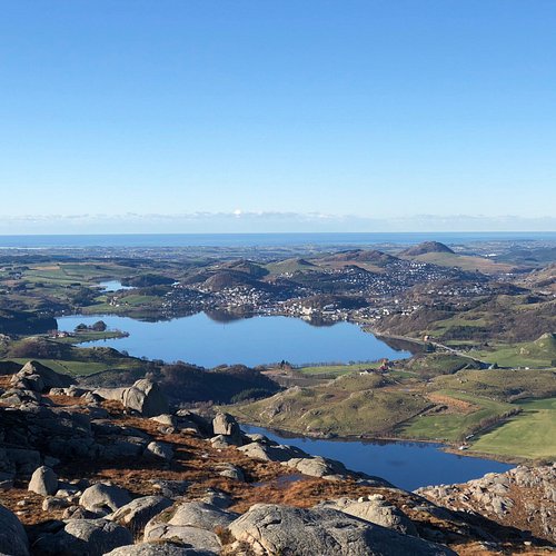
6 Outdoor Activities in Gjesdal Municipality That You Shouldn't Miss
Discover the best top things to do in Gjesdal Municipality, Norway including Fitjanuten Hiking Trail, Frafjord SUP & Kayak Center, Husavatnet, Hike from Stole to Skreda, Hike from Blafjellenden to Hunnedalen, Gloppenuten.
1. Fitjanuten Hiking Trail
2. Frafjord SUP & Kayak Center
Overall Ratings
5.0 based on 24 reviews

Welcome to Frafjord SUP & Kayak Center. We are located at Frafjord in Gjesdal Municipality just under one hour’s drive from Stavanger in Rogaland, Norway. We love paddling through the amazing fjords and are ready for you to join!
3. Husavatnet
Bathplace near the Kyllingstad community hall. Beach, toilet, football pitch, playground. Good access for disabled peoples. Parking
4. Hike from Stole to Skreda
Starting Point: The walk begins at Stole Turisthytte. Description: From the cabin, walk eastwards through oyestoldalen to oyestol. Walk through the narrow gorge called Trongane which at a first glance appears impassable, but there is a paved mountain road through the gorge. At the end of the gorge the valley opens up, continue straight ahead over the path crossroads to the Flaeet (flat area). As you come to the 'Heimre Trongane (a narrow valley / canyon), the terrain becomes more hilly, continue until the landscape opens up again keeping above the small hill marked Brudle on the map. ('Brudler' are stones laid in a long row and are associated with an old wedding tradition. Traditionally, stones were laid by the bridal couple and their guests on their way to the wedding celebration. (There are many such 'Brudle' to be found in Sirdal). Continue down the ravine to Indra Grunnetjodn tarn, from here walk along Skredane through Skredadalen to Skreda. For a detailed description including maps and information etc buy the guidebook 'Hiking in Sirdal' which includes Kjerag and Sirdals Seven Summits
5. Hike from Blafjellenden to Hunnedalen
Starting Point:The hike begins at Blafjellenden turisthytte. Description: The trail starts in the middle of the cabins at Blafjellenden. Follow the signposted path in the south-easterly direction towards Hunnedalen. After five minutes you begin a 200 meter ascent up to 820 meters (allow roughly 45 min). At the top of the ravine the path crosses the left hand side of the marsh, look for boards that are laid out along the bog. Pass between two tarns, stepping stones have been placed in the tarn so that it is easy to cross. The landscape is very hilly. The tarns are more or less your means of finding your bearings. Continue in the south-easterly direction past a lake where another path crosses yours on your left hand. At the end of the lake follow the right side of the river that flows into an elongated tarn 150 meters ahead. Follow its short north-western side to the end and then turn south-east along the long side of the tarn. At roughly the halfway mark, the path veers towards a round tarn on your right, which you follow along its shore. At the end of these tarns, cross a sheep fence and then climb to the top of an outcrop from where you can see the cabins in Hunnedalen. You then follow the wide path of the old thoroughfare and farm road down to the main road in Hunnedalen (Hogaleitet). For a detailed description including maps and information etc buy the guidebook 'Hiking in Sirdal' which includes Kjerag and Sirdals Seven Summits.

