10 Hiking Trails in Franz Josef That You Shouldn't Miss
The quaint West Coast, South Island town of Franz Josef is named after the Franz Josef Glacier. Which in turn, legend has it, is named for a girl whose lover died in a fatal fall. She cried so much that her tears pooled, eventually freezing into a block of ice. The magic of this fable isn’t lost on the town or the tourists who flock to the tragically romantic site.
Restaurants in Franz Josef
1. Roberts Point Track
Overall Ratings
5.0 based on 76 reviews
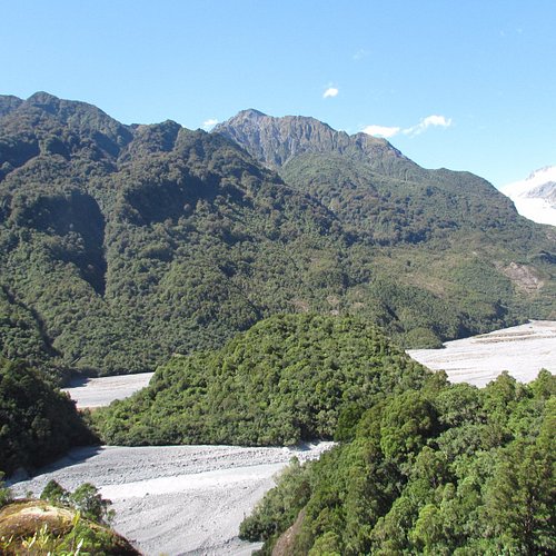
Starting from the Douglas Bridge, Roberts Point Track winds up the true right of the Waiho (Franz Josef Glacier) Valley, over ice-carved rock and across many side streams to a viewpoint high above the glacial ice. In around an hour the track opens out onto ice smoothed rock outcrops at Hende's Hut. This hut is unsuitable for overnight accommodation, but it does provide a sheltered lunch spot. The track climbs on through open scrubland to a suspension bridge crossing Rope Creek and continues steadily upwards to Roberts Point. The views from here are well worth the effort with the glacier, sheer rock walls, waterfalls and mountain peaks all visible. Time: 5 hr return from Alex Knob/Lake Wombat car park; or 5 hr 20 min return from glacier car park Distance: 11 km return from Alex Knob/Lake Wombat car park; or 12.3 km return from glacier car park Please contact the Franz Josef Visitor Centre for safety updates before attempting this track.
Reviewed By nzwestie - Hamilton & Waikato Region, New Zealand
Loved this walk. Def recommend it if you have the time. What a surprise to see the glacier when we got to the top. You do have to be careful. We just wore trail shoes, had plenty of water in our camel packs (as that means no carrying of anything) cameral swinging of my neck. We are in our late 50's, took us about 2.15 up and the same down. Sometimes going down is harder than going up. It is a great walk as it has bridges, water crossing, rock climbing etc. We loved it and would def recommend it.
2. Alex Knob Track
Overall Ratings
5.0 based on 2 reviews
Reviewed By ArjenKl - Napier, New Zealand
It’s a big hike through the rainforest to make it to the Alex Knob peak at 1303m. Do the hike only on a clear day to have a better chance of being rewarded with a beautiful view of the Franz Josef qlacier (because weather can always change). We did it in a 6,5 hour return. Sadly we didn’t have a view of the glacier at the top due to clouds.. We saw the glacier on the other two lookouts on the route though! Have some boots with good grip and expect some climbing with your hands! It can be very slippery!
3. Franz Josef Glacier
Overall Ratings
4.5 based on 3,579 reviews
Westland Tai Poutini National Park, renowned for its Franz Josef and Fox Glaciers and the beautiful walks from 5 minutes to 8 hours that you can do in this area to view these amazing ice features, native forest, wildlife and waterfalls. The track up the Glacier river bed is 5.4 km return via same track Suggested duration 1 hr 30 min •This track is sometimes closed due to ice collapse, flooding or landslides – check the latest track conditions and weather forecasts at the Westland Tai Poutini National Park Visitor Centre before starting your trip. •Always take warm and waterproof clothing as the weather can change rapidly. •Carry drinking water, insect repellent and sun protection. •No drones allowed.
Reviewed By greg_wanders - Auckland Central, New Zealand
An enjoyable and picturesque walk through the Franz Josef Glacier Valley. From the car park its a 1.5 to 2 hour walk depending on how long you stop for photographs. Several waterfalls all around as you make your way to the glacier wall. The Glacier wall itself is quite a way away from the view point as it is receding, though it is still awesome to be so close. Maybe a good idea to keep this in mind so as to not be disappointed. Combine the glacier valley walk with two short walks from the car park (Sentinel Rock for Panoramic views and Peters Pool for reflections) and you have great day out on the west coast. A great FREE way to enjoy you time by the glacier, although you have the options of helicopter tours or heli hikes to get further up close. Would highly recommend this walk in good weather. If it is raining and you have spare time, I would save it for when you get a break in the weather.
4. Te Ara a Waiau Walkway/Cycleway
Overall Ratings
4.5 based on 2 reviews
Always check the website for changes that might affect your trip.
5. Tatare Tunnels Walk
Overall Ratings
4.5 based on 112 reviews
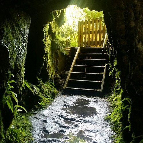
After 10 minutes walk on a four wheel drive road, the track climbs gently then drops to a view of the scenic Tatare Gorge. The track then becomes steep and narrow for the short climb to the Tatare Tunnels. If you wish to explore the tunnels you will need a torch and a raincoat, and you may get wet feet – the water will be ankle deep. The track stops at the old wooden flume at the end of the first tunnel. Know before you go •Check the current track conditions and weather forecasts at the Westland Tai Poutini National Park Visitor Centre before starting your trip. •Always take warm and waterproof clothing as the weather can change rapidly. •Carry drinking water, insect repellent and sun protection at all times.
Reviewed By AndrewW41
Took us 40 minutes to walk into the tunnel entrance, The last section is a narrow gravel walkers track that is up and down the hills, We walked 200meters into the tunnel (with no end in sight) in 100mm deep water most of the way, got back out and google says the tunnel is 500meters long... Cool tunnel about 1-1.5m wide and 2 meters high
6. Peters Pool Walk
Overall Ratings
4.5 based on 78 reviews
This fully-accessible walk winds through the rainforest to a small kettle lake, which was formed by ice melting amongst glacial moraine about 200 years ago. Enjoy the reflective views of the glacier and mountainpeaks in this tranquil setting. Getting there Drive or walk south from the Franz Josef Waiau township across the Waiho River bridge and turn left onto the Glacier Access Road or Te Ara a Waiau. Drive or walk for approximately 4 km to the car park at the end of the road.
Reviewed By HelenaT975 - Tauranga, New Zealand
This track starts from the Franz Josef glacier carpark and leads to a beautiful small pool which reflects the surrounding mountains. Highly recommend checking it out when you are in the area.
7. Sentinel Rock Walk
Overall Ratings
4.5 based on 49 reviews
This short steady climb up a now bush-covered ice-scraped rock offers the most impressive views of the glacier and the Waiho River. Information panels at the viewpoint show dramatic photos of the glacial retreat, making it one of the best places to appreciate the power of the glacier. Sentinel Rock emerged from beneath the glacier in 1865 and is an example of how the glacial ice ground the hard schist bedrock into a Roche moutonnee or ‘rock sheep’. Since 1909 the glacier has retreated over 3 km and plants have progressively colonised where a veneer of rubble has been dumped over bedrock in the valley. Getting there Drive or walk south a short distance from the Franz Josef Waiau township across the Waiho River bridge and turn left onto the Glacier Access Road or Te Ara a Waiau. Drive or walk for approximately 4 km to the car park at the end of the road.
Reviewed By agentbates2014 - Wellington, New Zealand
Well worth the steeper path at the end. Great viewpoint but a shame (and shameful) that the glacier is retreating at such a fast pace. Informative panels at the view point show the retreat over the last 125 years.
8. Callery Gorge Walk
Overall Ratings
4.0 based on 50 reviews
Reviewed By EverWonderer - Greater Melbourne, Australia
It's an easy walk (allow 1.5 hrs in total) to the beautiful gorge, past waterfalls and stunning ferns. I did my walk in the afternoon and only saw one other person on the trail. It's relatively flat, with some short gentle incline sections but can be done by kids. No need to be super fit. The suspension bridge at the end was the highlight
9. Terrace Walk
Overall Ratings
4.0 based on 24 reviews
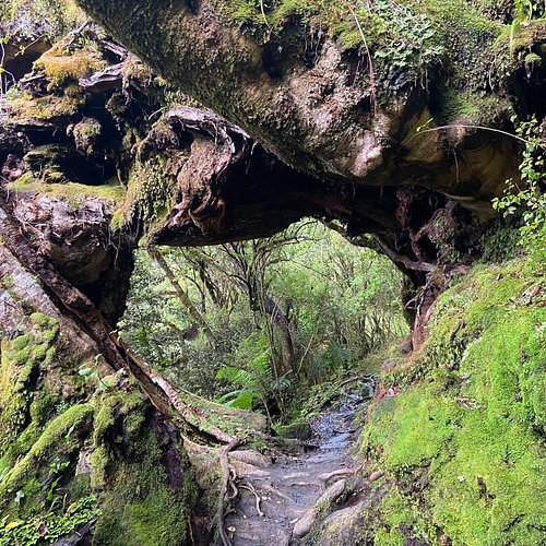
This easy walk winds a short way along the bush-clad terraces at the south end of the village. There is no access beyond the bridge due to a slip and you will need to return the way you came. Take a torch and explore this walk at night to see glow-worms in the forest, especially under and around large fallen trees alongside the track. Getting there The walk starts off State Highway 6, at the southern end of Franz Josef village near the 'Our Lady of the Alps' church on the left hand side of the road heading south towards Fox Glacier. The track entrance has a very small parking area, but there is plenty of parking in town just a short walk away.
Reviewed By klvmar
The Terrace Walk is located at the southern end of Franz Joseph Village on State Highway 6. The trail is relatively flat until the last few meters, when it winds uphill and becomes somewhat rocky. It is a lovely walk during the daytime, with a variety of moss covered trees, ferns, and other beautiful rain forest vegetation. At night, the glowworms sparkle along the track, especially around fallen trees. Round-trip takes about 30 minutes. We walked the track during the day to scope out where we thought the glowworms might be, and then returned again at night. Hint: no need to scope it out; the glowworms are everywhere!
10. Canavan's Knob Walk
Overall Ratings
3.5 based on 7 reviews
The first 800 metres of track is along the river stop bank. A short, but steady climb then takes you through rainforest to the top of this granite outcrop, where you will get commanding views of the sea and lowlands to one side, and up the Waiho River to the glacier and Southern Alps Kā Tiritiri o te Moana from the other. The granite of Canavans Knob is much older than the schist rocks of the glacier valley across the Alpine Fault Line, and therefore it survived the scraping of glacier ice 9000 years ago. Getting there 1.2 kilometres south of Franz Josef turn right into a sign-posted car park and the start of the Canavans Knob Walk. Time from car park: 1 hr return Distance from car park: 3.2 km return Alternatively, walk from Franz Josef across the Waiho River Bridge and turn sharp right onto a stop bank. Follow along until you see the track markers for the track. Time from Franz Josef township: 1 hr 40 min return Distance from Franz Josef township: 6.3 km return


